

ranch and Wildlife
get a better view of your ranch


What we can do for you
Thermal Drone Game Counts utilize thermal imaging cameras to detect and count wildlife based on their heat signatures. This method allows for accurate counting even in vegetation or low-light conditions. The data is then mapped and analyzed, providing precise game counts and valuable insights for wildlife management.
Extended Hunting Seasons
Landowners in the (TPWD) Texas Parks and Wildlife (MLDP) Managed Lands Deer Program can take advantage of Drone Surveys to extend their hunting season.
Save money on taxes
In Texas, landowners can maintain lower property valuations through the 1-D-1 Wildlife Exemption by performing at least three of seven approved wildlife management activities, including an annual census count.
Got a question? Call us (325)-642-8815
Game photo map
Every photo and data point taken with a drone has GPS data baked into it. Using this data we can display points and images in a convenient map format. This allows our clients to see where their wildlife is at the time of the survey.
This feature is included in our Pro package.
Click the MapHub button in the corner to view the map in full screen.
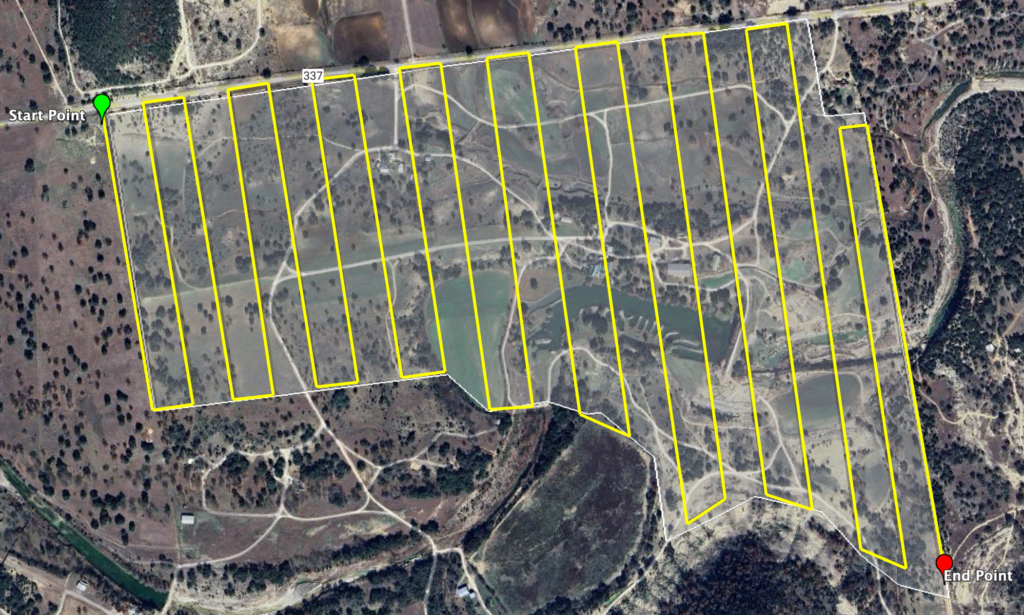
How the flight works
Our wildlife surveys follow a preplanned flight path. This ensures that we cover every inch of your land. We hold on to these flight paths for future surveys making them easily repeatable.
We count the wildlife as we go, however, if the animal is hard to make out we can pause to get down closer with the spotlight to identify it.
We also make the full remote recording available to you in case you want to relive the whole flight.
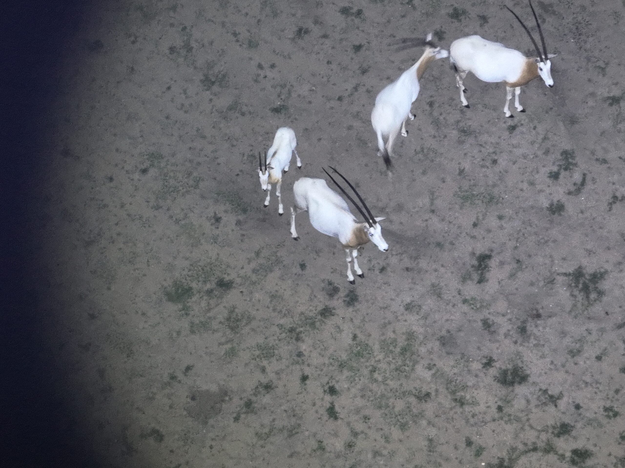

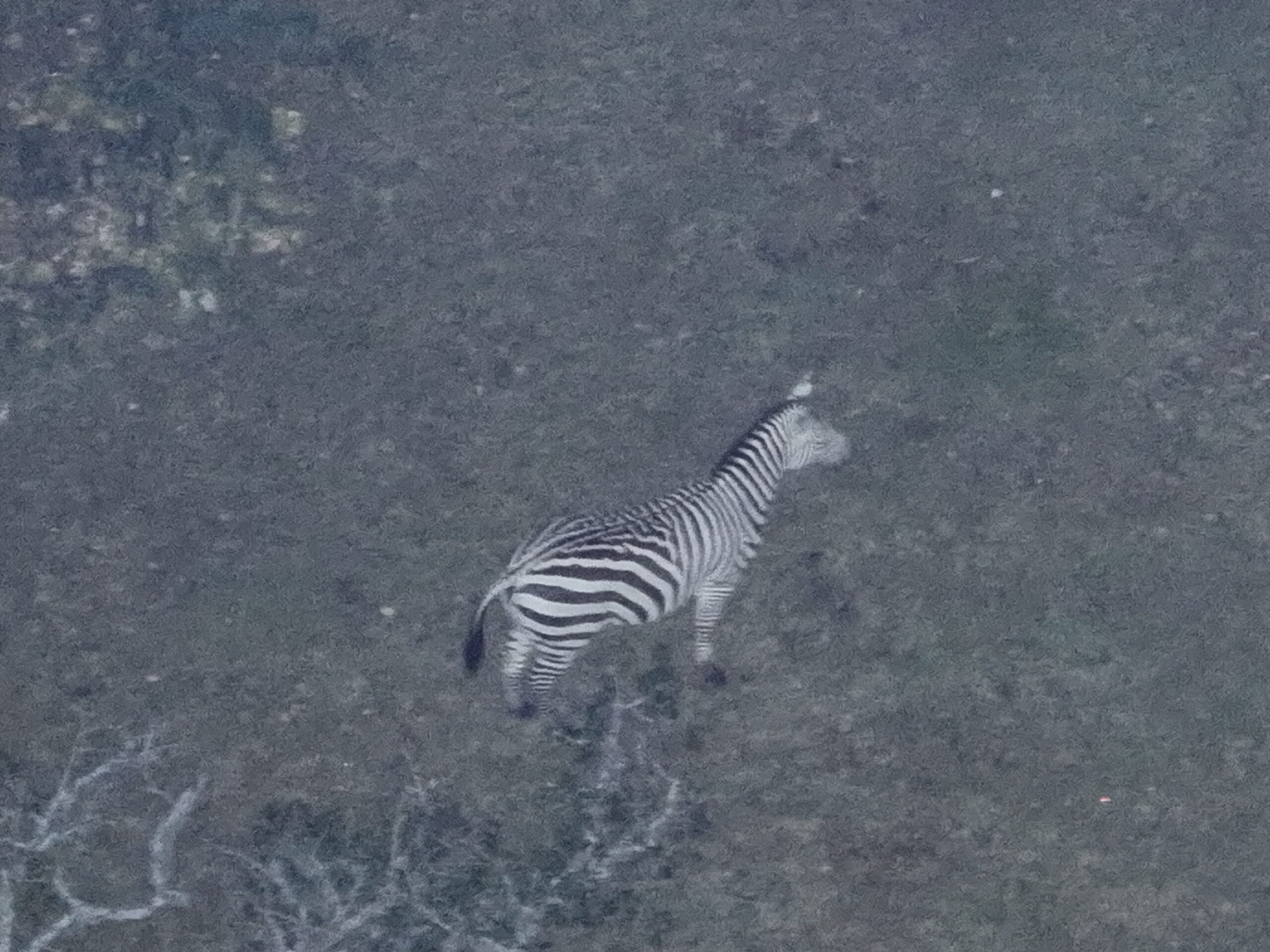

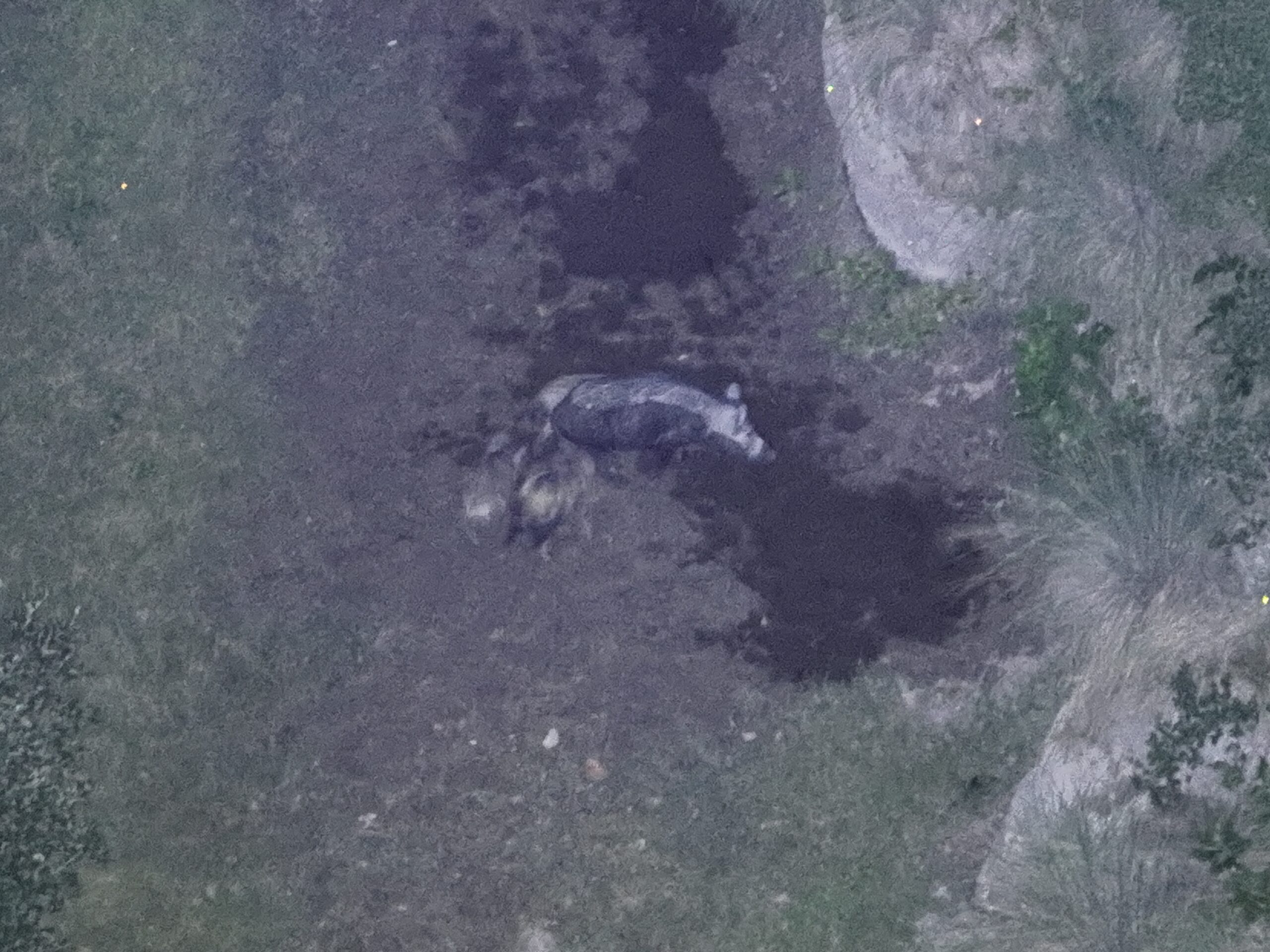

Spotlight photo & video
With a high-powered spotlight attachment for our drones, we can see your land even in the dead of night. Every wildlife survey we do will come with some highlight photos, however our Pro package will come with more photos and some short video clips of stand-out animals!

Personal Report Webpage
We want to make it as easy as possible for our clients to view their data from anywhere. Every job we do gets delivered to the client via a Personal Report Webpage. This is a tailor-made, password-protected webpage for each ranch or property. It will hold every survey, photo game map, image, video, and file we ever do for you all in one spot. This makes it easy to compare against past counts and see how your wildlife evolves, as well as making it easy to share.
All survey data will also be put into a simple PDF report for printing and emailing.